Aerial Survey & Drone Mapping Services for High-Precision Geospatial Data
Optimize resource planning, reduce costs, and improve efficiency with our advanced drone-based services across Florida.
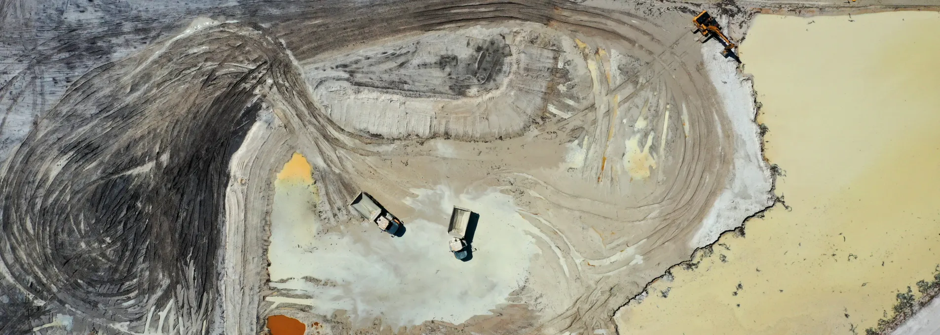
Stockpile Surveys
Optimize Inventory Management with Accurate Volume Tracking
Effective inventory control is crucial in mining, construction, and material management. Our Stockpile Surveys use high-precision drone photogrammetry to measure volumes accurately and efficiently.
Optimize Stockpile Management
Monitor Stockpile levels accurately to prevent material shortages
Improve supply chain planning with up-to-date inventory data
Enhance cost control by minimizing material overuse
Earthwork Analysis
Cut-and-Fill Volume Measurement for Cost-Effective Planning
Precise earthwork calculations are essential for infrastructure and construction projects. Our Earthwork Analysis service provides accurate cut-and-fill volume measurements, reducing waste and optimizing site development.
Optimize Earthwork Planning
High-accuracy excavation and embankment calculations to prevent over-excavation
Minimize project overruns with precise material usage data
Ensure regulatory compliance with verifiable survey results
Building Linework
CAD-Ready Structural Outlines for Efficient Design
For architecture, engineering, and construction (AEC) firms, our Building Linework service transforms aerial imagery into detailed CAD-compatible blueprints, improving accuracy and workflow.
Enhance Design Accuracy
Extract high-precision structural linework for CAD and BIM applications
Save time and labor costs by reducing manual drafting
Enhance project planning and design accuracy with digital blueprints
Road Linework
High-Resolution Road Mapping for Infrastructure Development
Accurate road geometry is critical for transportation, civil engineering, and urban planning. Our Road Linework service provides precise mapping of road networks for enhanced project execution.
Enhance Road Infrastructure
Capture road geometry and alignments for better infrastructure planning
Integrate seamlessly with GIS and civil engineering workflows
Improve safety and traffic planning with high-resolution mapping
Topographic Survey
3D Terrain Modeling for Site Evaluation & Planning
Topographic surveys are essential for land development, construction, and environmental planning. Our Topographic Survey service provides high-accuracy elevation models, enabling informed site assessments.
Improve Site Evaluation
Reduce survey time and labor costs with automated aerial mapping
Obtain precise elevation and contour data for better decision-making
Seamless GIS and 3D modeling integration for accurate land development
Related Industries
Discover how FAST's drone surveying solutions are transforming industries


Didn't Find What You Need? Let's Talk!
We understand that every project is unique, and sometimes standard solutions don't cover every requirement. If you need a customized aerial surveying service or have specific questions, our experts are ready to assist you.
Why Connect with Our Experts?
Personalized Consultation
Backed by real-world case studies and industry applications
Custom Solutions
Tailored drone data services to meet your project's exact needs
Quick Response
Our team is ready to help you find the best approach