Aerial Surveys for Civil Engineering Workflows
Elevation models, CAD linework, and surface data from aerial surveys for civil engineering projects.
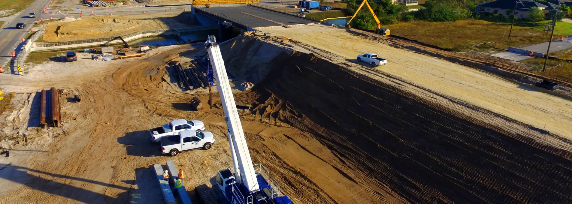
Engineering-Grade Mapping at Design Speed
FAST delivers drone surveys for site planners, engineers, and PMs. From pre-construction grading to final as-builts, our workflows accelerate timelines and reduce site visits—without compromising design precision.

Designed for Civil 3D, Built for Real Sites
With contour models, volume analysis, and CAD-ready linework, FAST surveys deliver the right geometry in the right format. Avoid PDF rework with structured surfaces and start working with surfaces and layers built for your workflow.

Verifiable Accuracies
We set RTK GCPs and tie into datums used on site for design. Our data is verified to tolerances.

Delightfully Dense Data
With our methods, we capture millions of points even on the smallest of sites, allowing us to generate high quality deliverables your team can trust.

File Type Agnostic
Whether you need LAS, DWG, DXF, OBJ, TIF, or others, we deliver in our clients needed format.
Why Civil Engineers Survey with FAST
Consistent, validated, and controlled accuracy for site grading and surface modeling.
Average time from flight to delivery.
Enables early design validation and pre-construction analysis.
Structured for alignment with planning and review cycles.

Custom Survey Packages for Design & Review
Whether you're preparing submittals or reviewing construction, we tailor formats and scope to your phase.
Core Mapping Tools for Site Evaluation
Support grading prep, access layout, or milestone coordination through spatial insights.


Civil Projects, Regionally Executed
Every region presents different technical, regulatory, and terrain-based challenges — our workflows meet them with speed and precision.
Civil Teams Ask Us
Explore how drone survey data can enhance your design, reduce rework, and meet permitting requirements.
If the specs call for a tenth of a foot or looser for tolerances, our aerial platforms perform to spec.
We work to deliver in whatever format our clients need. We call this 'file-type agnostic.' Our team has significant experience exporting and delivering data in PDF, DWG, DXF, SHP, GeoTIFF, GeoJSON, and other formats - too many to list. If you use it, chances are we support it.
Most projects under 100 acres are completed in 2 weeks from flight to delivery and can be rushed in as little as 3 days. Projects over 100 acres are evaluated by scope and size.