Drone Surveying in Orlando for Civil, Asphalt, and Land Development
Cutting-edge aerial mapping for builders, engineers, and developers across Central Florida
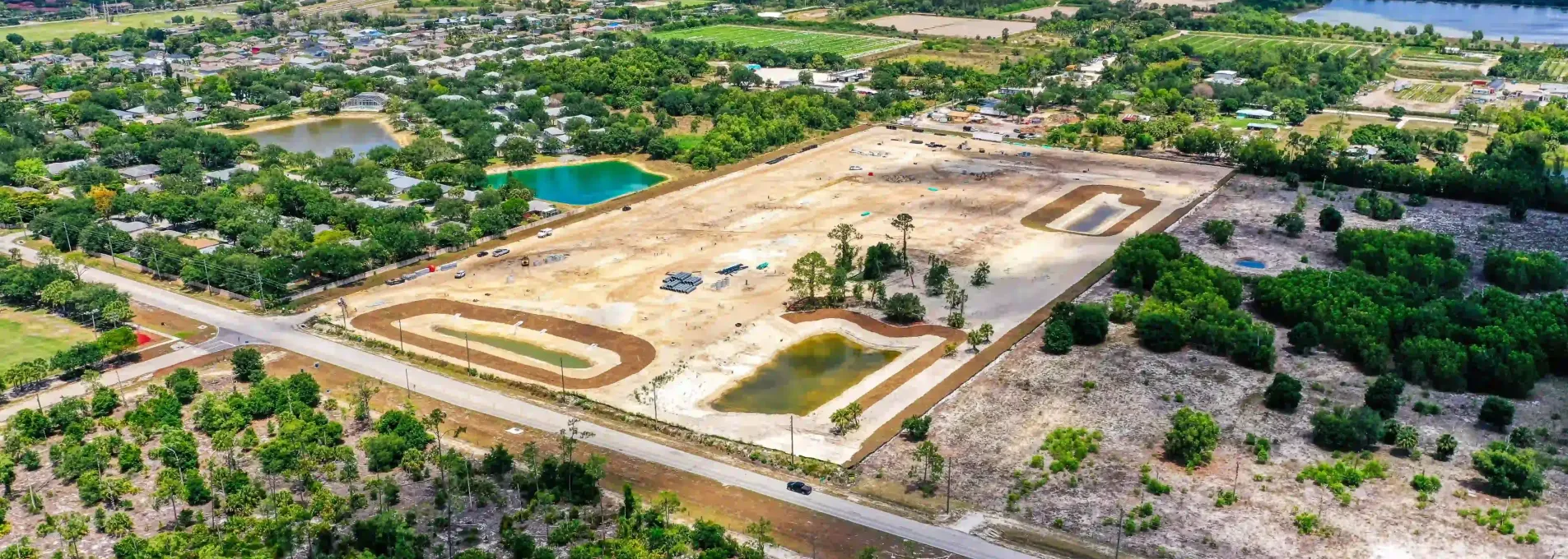
High-Precision Mapping for a Fast-Growing Region
Orlando's rapid growth—from Lake Nona's tech corridor to booming subdivisions in Horizon West—demands accurate and efficient surveying solutions. FAST delivers actionable aerial data for infrastructure design, stockpile volumes, and site grading, helping teams stay ahead of schedule.

Why FAST Is a Fit for Orlando
Typical turnaround for processed maps in active development zones.
Acres surveyed in the Greater Orlando area in 2024.
Client retention rate for repeat survey packages.
Ground-validated accuracy using RTK/PPK and GCPs.

Stockpile Tracking for an Asphalt Plant in Orlando
A high-volume asphalt plant in East Orlando needed reliable stockpile measurements to maintain supply to roadwork contractors. With constant material rotation and tight dispatch schedules, traditional surveys weren't fast enough.
FAST delivered drone-based stockpile surveys every two weeks, providing 3D volume data within 24 hours. This helped the operations team cut emergency orders by 10% and optimize reordering cycles. It's one of several Orlando-area sites we support with recurring aerial mapping for industrial production.

Who We Help in Orlando
FAST provides tailored drone survey solutions for contractors, engineers, municipalities, and more — wherever accurate mapping adds value.


Topographic Mapping for Central Florida Growth
From Lake Nona to Horizon West, FAST supports Orlando's growth with drone-based topo and CAD-ready deliverables.
Orlando Location FAQs
Common questions from engineers, project managers, and developers working in and around Orlando.
We cover all of Central Florida — including Orlando, Lake Nona, Winter Park, and Apopka.
Most surveys in the Orlando area are completed within 1–3 business days, depending on weather and site size.
Yes — we support civil, engineering, and development teams with customized surveying solutions tailored to their project requirements.
Let's Get Your Orlando Site Mapped
Whether it's cut/fill modeling, stockpile volumes, or road design data, FAST helps you move faster and build smarter in the Central Florida region.
Trusted by contractors, engineers, and developers across Orange County
Based in Florida
We work exclusively across Florida with certified FAA Part 107 pilots.
Fast Turnarounds
Standard Orlando jobs are delivered within 24–48h.
Survey-Grade Accuracy
Drone mapping results validated to ≤3cm RMS error.