Drone Earthwork Analysis for Accurate Cut and Fill Measurement
Monitor cut and fill changes over time with repeatable drone earthwork analysis.
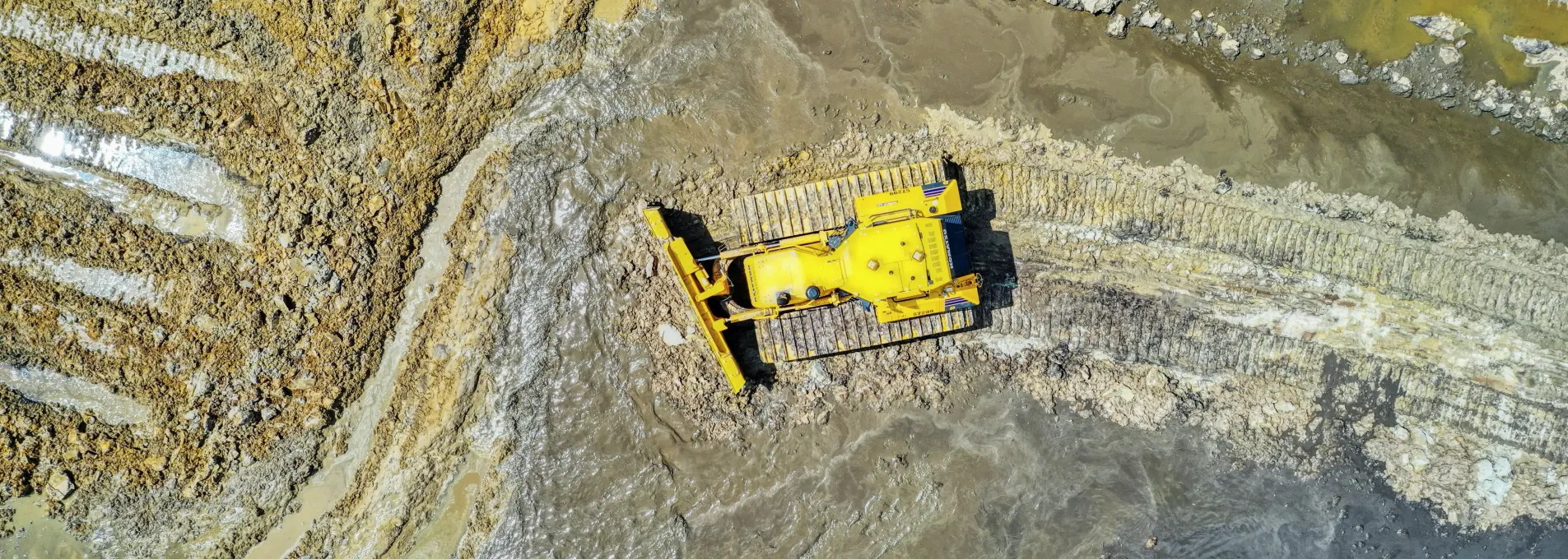
Surface Change Visibility with Measurable Precision
FAST reveals cut/fill metrics and grading adjustments over time through drone-based surface alignment—supporting material tracking and site balancing.

Topographic Modeling
We map elevation changes with precision to guide grading, optimize material use, and track earthwork progress with confidence.

Cut/Fill Measurements
Surface-to-surface comparisons reveal material shifts and guide field teams with clear insight into grading progress.

Volume Tracking & Validation
Ideal for verifying quantities moved—track excavation consistency, confirm pay estimates, and document progress across phases.

Streamlined Data Collection
Drone-based surveys increase accuracy, minimize disruption, and shorten timelines—especially valuable when flown on a recurring schedule.
Drone-Based Surface Comparison
Our process identifies surface changes and elevation shifts using drone-based inputs aligned over time to support grading and material analysis.

Workflow Overview
Flight capture over target area with high-resolution imagery.
Surface modeling and elevation comparison.
Differential interpretation with cut/fill regions.
Key Earthwork Metrics
≤ 5%
Volumetric accuracy of 5% verified with RTK GCP workflows.
10 Days
Our standard timeline for most sites with rush options available upon request.
Material Visibility
Resolve disputes, verify billing, and support planning—with data that is legal, licensed, and loved by clients.
Surface Insights When You Need Them
Request one-time grading insight or align observations to your construction cycle.
On-Demand Sitework Surveys
Get grading visibility and surface context at key project points.
Request a One-Time SurveyOngoing Surface Monitoring
Observe cut/fill or grading changes over time and phases.
Talk About Recurring PlansSupports Complex Site Development
Cut/fill models and elevation data bring clarity to design planning, grading, and construction preparation.


Where Earthwork Mapping Saves Time & Cost
These regions highlight how drone-based cut/fill modeling accelerates grading workflows — but FAST delivers this service anywhere in Florida.
FAQs About Earthwork Surveys
We answer the most common questions about drone-based cut/fill mapping and deliverables.
Our process analyzes terrain changes using differential layers and elevation data.
Yes. Our spatial references are structured to support common workflows in design and planning environments, including those used in civil and GIS contexts.
Surface variation is typically analyzed with a vertical resolution of ≤3 cm when using RTK/PPK and GCP workflows. This supports layout review and grading interpretation.