Building Linework Extraction from High-Resolution Drone Imagery
Extract building outlines and trace permanent site features using precise drone imagery.
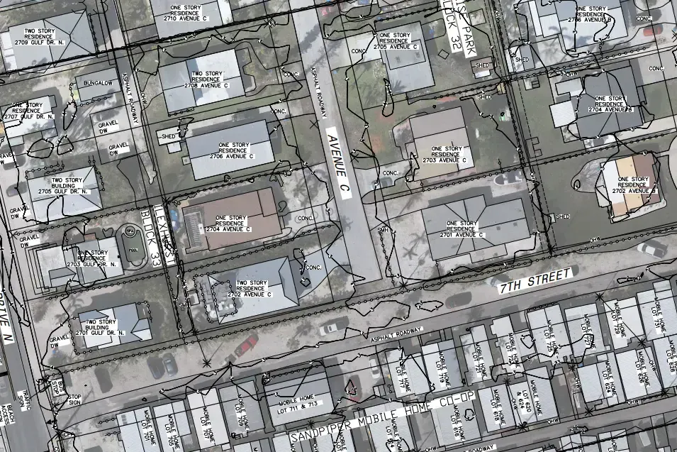
Capture Built Features with Minimal Disruption
From buildings to pavement edges, FAST captures visible features aligned to site geometry—ideal for planning validation and infrastructure layout.

Built Environment Features
We extract buildings, pavements, and access structures using high-resolution drone imagery.

Hardscapes and Outlines Aligned
Outlines and fixed features are structured for layout review and site coordination.

Mapped for Planning Use
Linework is aligned to geometry for use in civil and construction planning environments.

No Ground Crew Required
Our aerial workflow minimizes on-site presence and speeds up feature extraction timelines.
Site Features as Structured Linework
We extract outlines of buildings, pavements, and hardscapes to create spatial references aligned with site layout and infrastructure planning.

Workflow Overview
Flight capture over site using RGB drone imagery and RTK/PPK logs.
Surface classification of visible built features.
Geometry tracing and structured vector organization.
Key Mapping Metrics
≤ 0.12 US FT
Vertical accuracy within a tenth of a foot.
1–2 Weeks
Typical processing window from capture to delivery for typical sites.
Geometry-Structured
Mapped to visible structures and site geometry.
Adapted to New Builds or Renovation
Whether you're mapping new construction or checking existing features, we adapt to your planning cycle.
Single-Site Linework
Useful for design validation, permit support, or layout review.
Quote a One-Time SurveyProgress-Based Mapping
Capture surface or structure evolution as phases advance.
Talk About Recurring PlansReady for Any Mapping Need
Linework extraction delivers precise layout data for design validation, as-built records, or spatial planning.


Where Building Linework Delivers Clarity
From urban infill to institutional planning, we adapt our extraction workflows to surface only the site details you need — statewide.
FAQs About Linework Mapping
Common questions about formats, accuracy, and use cases for drone-based vector extraction.
We extract building outlines, pavement edges, sidewalks, retaining walls, fences, and permanent site improvements.
Yes. Linework is aligned using drone imagery and verified spatial references, making it suitable for layout planning and visual documentation.
While we are not a licensed surveyor, we offer PSM review and sign-off for permitting use when required.