Drone Mapping for Land Development
Topography, surface models, and CAD deliverables from drone surveys to support layout, grading, and site planning for land development.
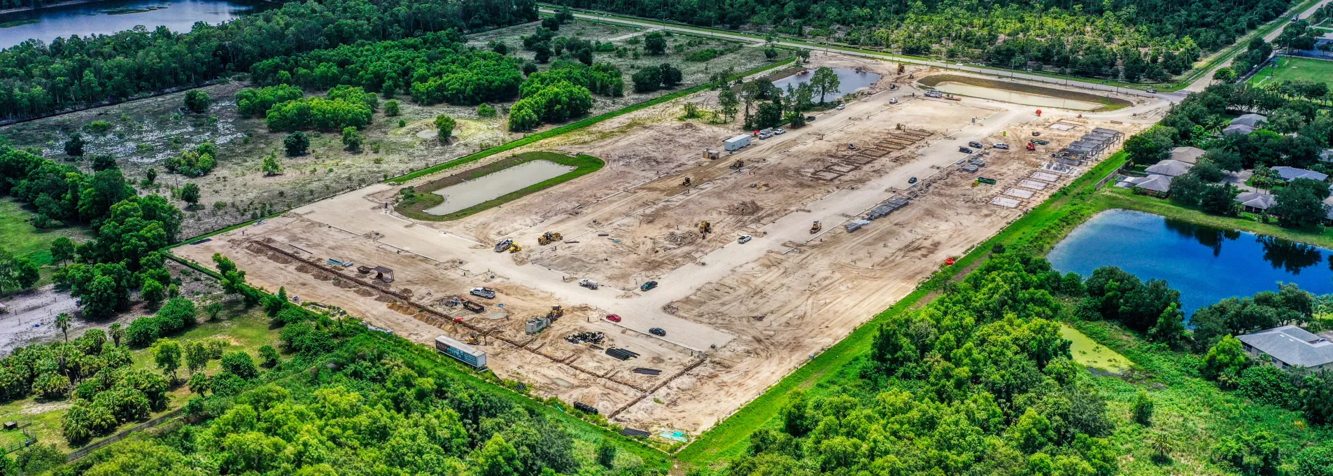
Surface Data That Keeps Projects Moving
We help land developers, engineers, and site contractors get topographic, linework, and earthwork data in days—not months. From cut, fill, & balance reports to topographic and drainage surveys, our drone mapping supports decision-making across the full site lifecycle.

Faster Survey Data, Smarter Site Planning
Avoid delays and reshoots with verified data you can trust. FAST provides licensed, insured, and accurate surface models, CAD linework, surface insights aligned to layout and phase and milestones.

On Demand Development Surveys
Whether you are settling a dispute mid-project or verifying existing conditions prior to clearing, FAST specializes in rapid deployment and delivery to keep your job on schedule.

Recurring Progress Checks
Verify designs, prove earth moved for contracts, and prevent late-stage surprises with our services and pricing specially designed to support high-frequency surveys.

Your Site, Your Data
We offer a range of services from contour mapping, to grade, slope, and station measurements, to stockpile surveys - delivered in your project's datum in your preferred file type.
What Developers Get with FAST
Typical vertical accuracy verified with ground control points designed specifically for aerial surveys.
Standard capture and post-processing cycle with rush options available in as FAST as 3 days flight to delivery.
Captures slope and fill variation across development areas.
Adaptable to different stages of development or layout.

Survey Packages by Phase & Scope
Whether you're pre-grading or ready for utility layout, FAST adapts deliverables to your timeline.
On-Demand Site Mapping
Use surface detail to support planning, lot distribution, or alignment.
Get a QuoteCore Mapping Tools for Development and Layout
Use spatial context to evaluate site readiness, grading progress, or planning adjustments.


Drone Mapping for Land Development
We help civil teams and developers keep pace with permitting, modeling, and layout demands across Florida's fastest-growing zones.
Developers and Engineers Ask Us
Find out how drone surveys support layout accuracy, grading efficiency, and project timelines.
Pre-layout, grading, and final surface stages are commonly captured for visual context.
Yes. Files are structured to support spatial alignment, slope referencing, or quantity studies.
Yes. Sites can be revisited periodically for consistent monitoring or comparison.