Real Sites. Verified Outcomes.
Explore how FAST supports industrial operations with measurable accuracy and faster decisions—across materials, layouts, and timelines.
Selected Case Highlights
FAST in action across yards, layouts, and volume tracking.

Pensacola Asphalt Plant
Serving as a regional hub along Florida’s Gulf Coast, this plant required volume tracking without disrupting continuous delivery schedules. FAST implemented a no-interference capture protocol during active operations, using RTK-corrected drone flights to ensure spatial alignment without site downtime. With consistent monthly data, managers now validate reserves and tonnage with confidence—supporting both compliance and dispatch.
Project Highlights
Captured asphalt operations without pausing access or haul-out.
Delivered quarterly comparisons of inventory volume verified with RTK workflows.
Enabled validation for whole-site inventory and utilization management.

Myakka Earth Movement Site
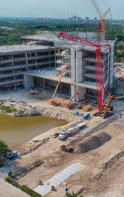
This inland Florida site had a mix of recycled and raw aggregates in changing configurations. FAST executed a rapid one-day drone survey, capturing both volumetric data and surface layout. Post-flight, the team applied contextual overlays to reclassify materials based on client input—eliminating guesswork and supporting inventory realignment.
Project Highlights
Captured site progress and dirt quantity moved
Rushed delivery with concurrent drone flights and rapid processing priority.
Data verified 1 million+ cubic yards of net earth movement.

Clewiston Sugar Plant
This large-scale agricultural processing facility required accurate modeling of surface changes across planting, harvest, and offload zones. FAST implemented seasonal drone mapping to document topographic variation and surface transitions over time. The data supported material handling planning and allowed operational teams to adjust for drainage, fill redistribution, and cane residue impact.
Project Highlights
Mapped surface variation during three different phases.
Used orthos and contours to inform offload scheduling.
Improved layout planning for sugar cane flow and containment.
Why Field-Validated Drone Mapping Matters
Typical RMSE accuracy for vertical control under RTK workflows.
Standard delivery window for validated survey-grade outputs.
Organized by layout, surface, and material context—ready for CAD or GIS.
Access-restricted yards? No problem—RTK drones and remote pilots minimize disruption.

Bring FAST to Your Site
Unlock faster field collection and better reporting with drone-powered mapping tailored to your site layout and material flows.
Built for material yards, infrastructure work, and ongoing asset tracking.
Florida-Wide Reach
RTK/PPK pilots deploy across Florida with minimal disruption.
Compliance-Ready Workflows
Data aligned to asset management, inventory cycles, and planning.
Data You Can Build On
Organized deliverables for integration into CAD, GIS, or reports.
Expert Insights & Knowledge Hub
At FAST, we uphold the highest standards in aerial surveying and mapping, ensuring precision, compliance, and excellence in all our operations.