Drone Mapping for Mining Sites
Monitor pit geometry, extraction progress, and volumetric change with accurate aerial mapping and stockpile reporting.
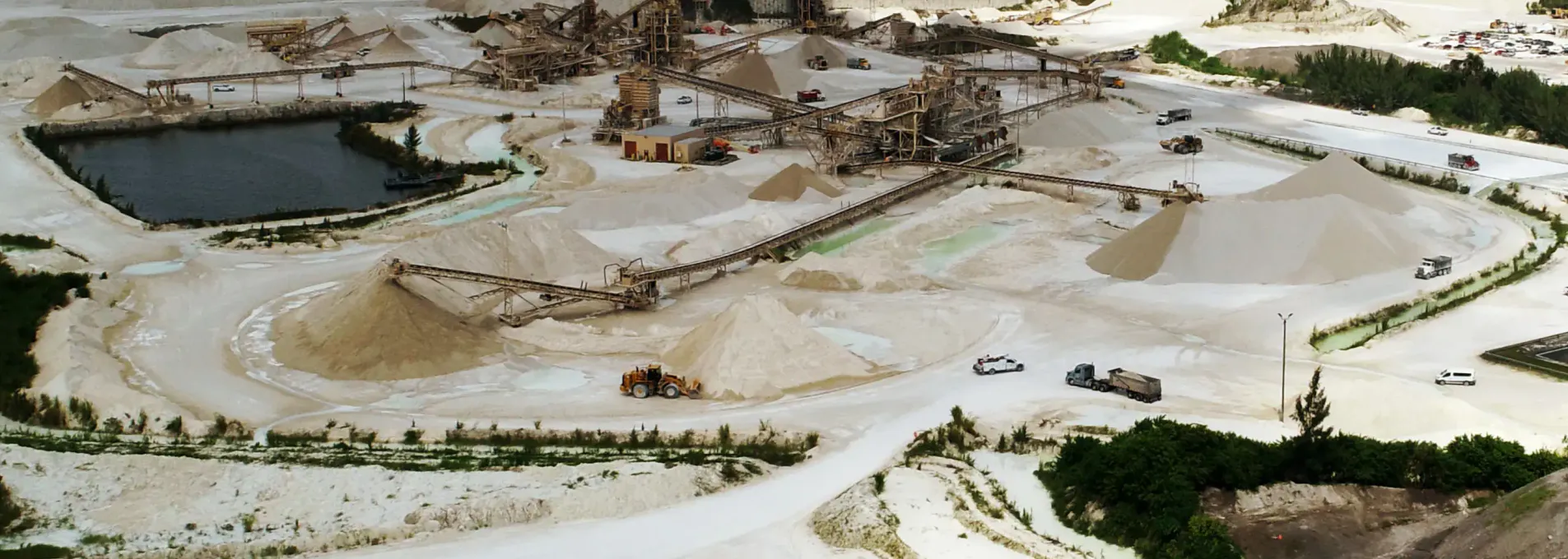
Volume, Terrain & Linework Without Disruption
FAST captures mine geometry, extraction progress, and material movement via aerial surveys. From pit base to perimeter, we deliver safe, repeatable surface data that supports planning, reporting, and operations.

Mining-Grade Accuracy at Every Flight
Whether measuring pit progression or modeling benches and blast zones, our drone surveys offer centimeter-level detail without interrupting operations or exposing personnel to active hazards.

Geometry of Pits and Benches
Visualize slopes, elevation transitions, and excavation stages for internal coordination.

Tracking Volumes Over Time
Track volume changes using our built-in-house volume comparison software - keeping all your data in one place.

Surface Feature Context
Map roads, berms, and site layout to support planning and operational routing.
Why Mining Teams Use FAST
FAST's Standard vertical tolerances for pit, bench, and elevation models.
FAST's standard flight to delivery timeline, with rush options down to 3 days available.
Get regularly scheduled flights at reduced costs.
Operated without halting extraction or logistics.

Mapping Aligned to Production & Safety
We tailor frequency, format, and scope to your mine plan—without compromising safety.
Custom Pit Mapping Plans
Adapt observations to specific zones or development phases.
Talk to an ExpertCore Mapping Tools for Extraction and Site Control
Support surface modeling, movement checks, and site visualization for operational awareness.


Drone Support for Extraction Sites
From pits to processing zones, FAST delivers mining-grade survey data to help operators stay compliant and efficient — statewide.
Mining Teams Ask Us
Explore how drone surveys reduce site risk, increase reporting frequency, and support production planning.
Yes. Recurrent observation enables comparative assessment of extraction or accumulation.
No. Flights are conducted away from production zones and coordinated with safety protocols.
Most projects are reviewed and returned within 2–4 business days depending on complexity.