Drone Mapping for Landfill and Recycling Sites
Track fill progression, model capacity, and get volumes with precision aerial survey data.
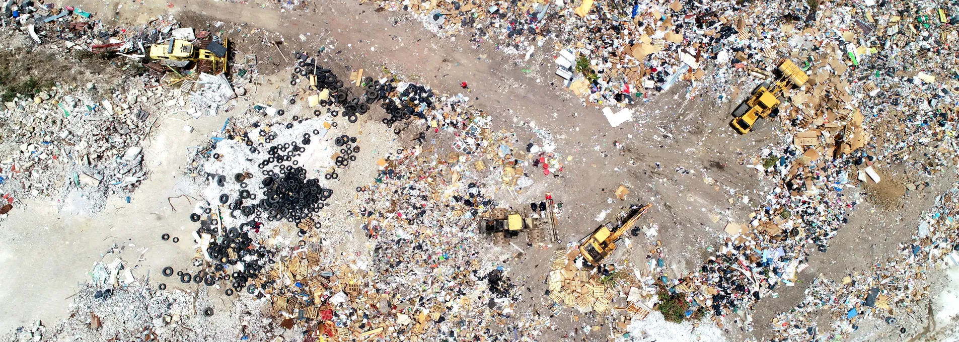
Surface and Volume Data for Regulated Sites
FAST supports landfill managers, engineers, and recycling coordinators with drone-based mapping. We capture surface topography, material stockpiles, drainage, and fill progression—faster and safer than boots on the ground.

Operational Planning and EPA Compliance with Verified Drone Data
Whether you need monthly capacity modeling or existing conditions of your site, our mapping supports EPA reports and operational planning with documented capacity and volume data.

Volume and Lifecycle Measurement
Keep your landfill operations on track with accurate, drone-based volume calculations and lifespan projections when integrated with future design overlays.

EPA survey and compliance reporting
Whether you already have an engineer or need a referral to one of our trusted partners, our aerial mapping and compliance services speed up your landfill compliance and reporting process.

Mulch and Metal Recycling Surveys
Monitor your material stockpiles remotely without disrupting operations or risking safety. Our drone surveys minimize liability and protect your team.
Why Environmental Teams Use FAST
Our vertical tolerances are tight, ensuring good data and low-friction compliance.
Standard timeline for data delivery post-flight.
Our PPK enabled aerial platforms capture millions of data points per site, enabling additional modeling, projections, and data insights.
Captured remotely, keeping liability low and machinery moving.

Mapping Built for Regulated Sites
From permit filings to internal operations, we deliver files in formats you can use across teams.
Core Mapping Tools for Fill Monitoring and Yard Review
Support grading prep, access layout, or milestone coordination through spatial insights.


Drone Support for Landfill Operations
From the coast to the interior, FAST adapts landfill workflows to meet Florida's reporting, staging, and operational needs.
Landfill & Recycling Managers Ask Us
Explore how drone survey data can enhance your design, reduce rework, and meet permitting requirements.
Yes. Surface trends and slope conditions are observable with periodic capture.
Yes. While we do not climb piles and fly remotely, our team must set ground control points in each corner and throughout the site. This is usually done with minimal on-site time and 0 disruption to your team's work.
Flights can be scheduled bimonthly, monthly, quarterly, or on-demand.
No. We just need access to set 6-12 ground control and checkpoints on your site. These help us validate our data.