surveying-services-cross-fade-1

The Future of Aerial Data in Construction: How Drones are Revolutionizing Site Management

The construction industry is rapidly evolving, with aerial data playing a crucial role in streamlining operations. The integration of drone technology has revolutionized site management, providing real-time insights, improving safety, and reducing costs.

Recent Entries

Showing 1 - 6 of 9 Posts
Article 6 1
Industries
Knowledge-base

May 12, 2025

Autonomous drones cut costs in infrastructure inspections

In 2025, infrastructure inspection is being redefined by a new generation of autonomous drones. These systems – often packaged as “drone-in-a-box” solutions – are enabling asset managers to conduct frequent, high-quality inspections with minimal human intervention, lower costs, and vastly improved safety outcomes. The Rise of Drone-in-a-Box Systems Unlike traditional drone operations that require on-site pilots, autonomous inspection systems are pre-programmed to launch, fly specific routes, and return to a charging dock without human input. These setups are being deployed at industrial facilities, power plants, bridges, and other high-value assets where regular inspection is critical. Paired with AI-powered analytics, these drones can process imagery in real time to detect anomalies such as cracks, corrosion, or vegetation encroachment. This allows maintenance teams to act swiftly before issues escalate, avoiding downtime or catastrophic failures. Advantages for Infrastructure Operators Autonomous drone inspections offer multiple advantages: Companies like Dow have reported significant reductions in labor costs and human risk after integrating autonomous drones into their asset management programs. Why Now? In 2024, the deployment of self-flying drones surged as regulatory frameworks matured and technology stabilized. Market forecasts project a 20% year-over-year growth in drone-in-a-box adoption between 2024 and 2025. With companies under pressure to improve operational safety and efficiency, and with AI detection models becoming more accurate and accessible, the timing is ideal. Infrastructure operators that rely on regular visual inspections – from utility firms to oil and gas plants – are actively exploring automation to enhance performance. A New Standard for Inspections The shift to autonomous inspection drones is not just about convenience – it’s about setting a new standard in asset monitoring. By leveraging drone platforms that can fly pre-set missions, capture detailed imagery, and feed that data into enterprise asset systems or maintenance dashboards, operators gain a complete, up-to-date view of their assets. Looking ahead, the integration of AI with historical inspection data will enable predictive maintenance – identifying weak points before they become failures. Combined with growing BVLOS (Beyond Visual Line of Sight) capabilities, this will make wide-area, unattended infrastructure monitoring a reality. For providers like FAST, who already specialize in aerial data acquisition and compliance with FAA Part 107, this evolution presents opportunities to offer fully automated inspection services. This includes hardware deployment, routine scheduling, and actionable insights that clients can use to minimize downtime and maximize asset life.

Read more
Drone flying over farmland capturing crop health data
LiDAR-scanning
Workflows

May 12, 2025

Precision agriculture 2025: Drones and AI transform crop yields

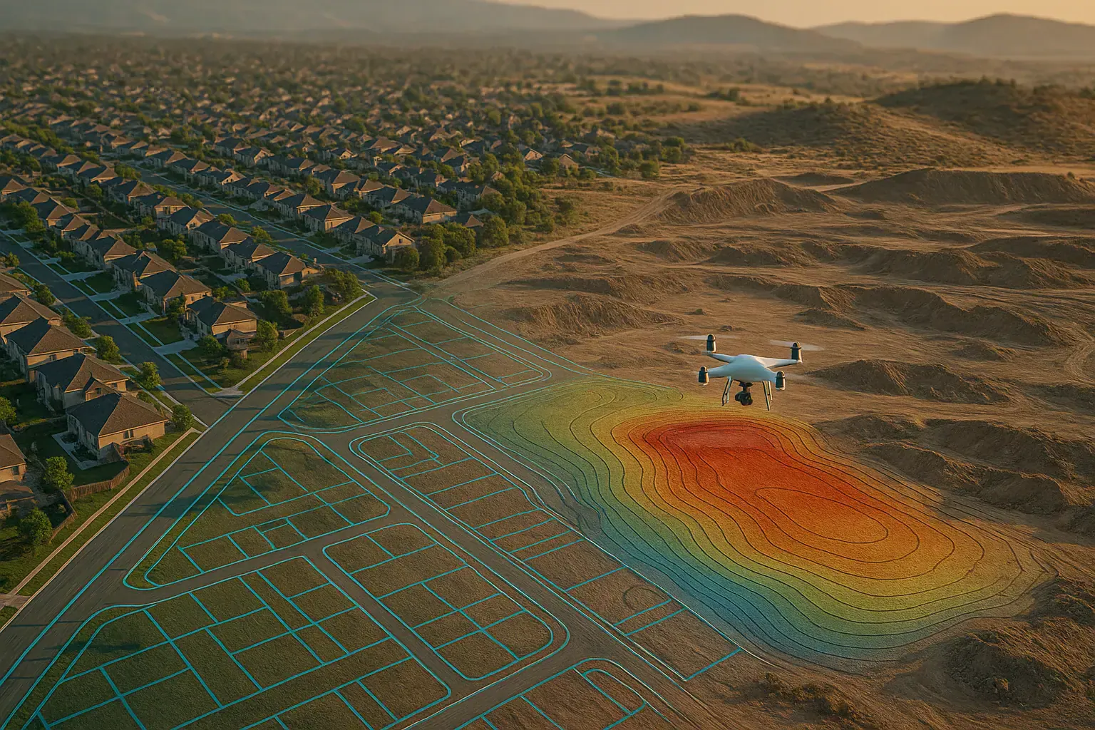
In 2025, agriculture is undergoing a transformative shift powered by drone technology and artificial intelligence. No longer limited to traditional methods, farmers are embracing “smart farming” tools that bring new levels of efficiency, sustainability, and profitability. Among these, drones equipped with multispectral sensors and AI platforms are playing a pivotal role. High-Tech Tools for Modern Farming Precision agriculture relies on granular data to make timely, informed decisions. Drones fitted with RGB and multispectral cameras can scan entire fields in minutes, detecting crop stress, nutrient deficiencies, or pest infestations with pinpoint accuracy. This imagery is then processed by AI-powered analytics platforms that generate actionable insights – from highlighting underperforming zones to recommending irrigation schedules. Unlike satellite imagery, drone data offers ultra-high-resolution views (often at sub-inch GSD), allowing growers to assess conditions plant-by-plant. Some advanced systems integrate with farm management software to generate prescription maps, enabling variable-rate application of water, fertilizer, or pesticides. Commercial Impact and ROI Studies and industry reports suggest that the adoption of drone-based imaging and AI analytics can boost yields by approximately 20% while dramatically reducing input costs. By targeting only the necessary zones for spraying or irrigation, farmers can cut pesticide use and water consumption – achieving both cost savings and environmental sustainability. This dual benefit has made the technology especially appealing to large-scale operations and agribusinesses. Farms managing thousands of acres are increasingly deploying fixed-wing drones for maximum coverage, supported by consultants who interpret the data and adjust treatment plans accordingly. Why Now? As global concerns around food security and climate resilience intensify, precision agriculture is gaining urgency. The cost of drone hardware and AI platforms has decreased, while ease of use has improved. Today’s systems offer near-real-time feedback, mobile access, and seamless integration with existing workflows. Moreover, regulatory acceptance and agronomic validation have cleared barriers to adoption. With proven results in crop yield improvement and input reduction, aerial data collection has shifted from experimental to essential for competitive agriculture. Toward a Smarter, Greener Future The role of drones in farming will only expand. As sensors get smarter and AI models become more predictive, farmers will be able to simulate outcomes, forecast pest outbreaks, and manage their land with even greater precision. For providers like FAST, which already specialize in multispectral drone surveys and AI analytics, this market shift presents a clear growth opportunity. By combining flight services with agronomic insights and digital integrations, aerial mapping companies can deliver measurable value to the agricultural sector.

Read more
Drone surveying a suburban development site for land use permitting
LiDAR-scanning
News-updates

May 9, 2025

How drones accelerate permitting for land development

Drone mapping is helping developers streamline due diligence, environmental studies, and planning approvals. With faster, more accurate site data, land development projects can move through permitting faster—reducing holding costs and giving teams a competitive edge. Introduction  Permitting is one of the most time-consuming phases in land development. Before a shovel hits the ground, developers must submit detailed site plans, topography, floodplain data, and environmental documentation. Traditional surveys can take weeks—delaying design and increasing costs. Drone-based mapping is changing that. With aerial data captured in hours and processed in days, teams gain a real-time view of the land and a head start on permitting deliverables. Delays in permitting often stem from missing or outdated data. Engineers may lack current elevation models, while planners need clear visuals to evaluate drainage or tree coverage. In many municipalities, permitting timelines are strict—but data quality determines how smoothly a plan is approved. Re-submissions or corrections can cost weeks. That’s where drone surveys shine: they provide high-resolution maps and models that feed directly into planning applications, engineering designs, and environmental reports. Drone workflows for land use and entitlement Modern drone platforms can generate orthomosaics, digital elevation models (DEM), and even tree counts using AI. These outputs are directly usable in planning workflows—from site feasibility and conceptual layout to preliminary engineering and environmental analysis. Data can be imported into AutoCAD, Civil 3D, or ArcGIS, enabling tight coordination across civil teams, architects, and planners. Benefits  With drone data, developers are reducing permit prep time by up to 40%. One Florida firm reported shaving three weeks off a subdivision application by submitting drone-based topography early. Agencies appreciate the clarity of aerial maps, and consultants get to design with better context. In addition, digital records from drones support future audits, adjustments, or plan revisions. Drone mapping is becoming a core tool for land developers looking to move faster and smarter. From site selection to permitting to final design, aerial surveys provide the clarity and accuracy needed to reduce risk and accelerate timelines. For any project on a deadline—or a budget—this is a strategic edge that’s hard to ignore.

Read more
Drone capturing digital twin of highway for enterprise GIS integration
Inspection
LiDAR-scanning

May 9, 2025

Digital twins and drones: transforming enterprise workflows

Digital twins created from drone imagery are helping firms centralize data and streamline workflows. By syncing with GIS and BIM, companies unlock real-time insights for construction, maintenance, and planning—transforming collaboration and cutting delays. As drone programs scale, many companies are moving from raw aerial imagery to integrated digital workflows. One major leap is the adoption of digital twins: up-to-date 3D models generated by drones and integrated into BIM or GIS platforms. These models offer a “single source of truth,” allowing teams to track changes, plan proactively, and collaborate across departments. But how exactly are these twins built and used? Traditional workflows often rely on outdated or fragmented data. A contractor may work from old site plans, while asset managers reference spreadsheets. This disconnect causes delays and costly miscommunication. A 2024 report found that data silos contribute to 35% of project delays in infrastructure. Digital twins aim to solve this by unifying drone data with enterprise systems—eliminating manual updates and enabling faster, data-driven decisions. Building a connected workflow with drone digital twins  Creating a digital twin starts with high-resolution drone imagery or LiDAR scans. These datasets are processed into photogrammetric 3D models or point clouds. Through cloud APIs and integration tools, these models sync with GIS and BIM platforms. From there, teams can annotate, measure, and track site changes—ensuring that decisions reflect the latest ground truth. This connected workflow is revolutionizing industries from civil engineering to utilities. Results / Benefits  Digital twins from drones deliver measurable impact. A European highway builder used 65,000 drone images to model a full corridor project, improving communication across teams and regulators. Companies report 30–50% faster project updates and 25% fewer data coordination issues. Integration also reduces manual reporting, improves transparency, and speeds up compliance reviews. Conclusion Digital twins powered by drone data are more than 3D models—they’re engines of collaboration and control. By bridging drones with BIM, GIS, and ERP systems, businesses gain visibility, reduce risk, and operate with real-time precision. Now is the time to turn drone imagery into actionable, enterprise-grade insight.

Read more
Commercial drone flying beyond visual range over infrastructure
News-updates
Inspection

May 9, 2025

New FAA drone rules to unlock BVLOS operations in 2025

New FAA BVLOS rules will eliminate many waivers and allow long-range drone missions by default. This change opens the door for inspections, deliveries, and mapping at scale—if your team is ready to meet compliance standards. Introduction  The FAA is finalizing rules that will allow beyond visual line of sight (BVLOS) drone operations without a case-by-case waiver. For drone programs in construction, utilities, and logistics, this is a major shift. With Part 108 expected by 2025, teams can plan long-range inspections and delivery routes with fewer regulatory barriers. But how can companies prepare now to take advantage of this moment? Until now, BVLOS drone missions in the U.S. required special waivers, limiting scalability. These restrictions made it hard to use drones for inspecting pipelines, surveying roads, or delivering goods over long distances. In 2024, lawmakers directed the FAA to formalize BVLOS rules, which are expected to replace waivers by 2025 (source: dronelife.com). This means operators must understand new requirements to remain compliant and competitive. What FAA Part 108 means for enterprise drone programs  FAA Part 108 will likely define the conditions under which BVLOS flights are allowed without special waivers. This could include new requirements for detect-and-avoid systems, pilot training, aircraft reliability, and flight risk assessments. For businesses, it means more predictable operations and fewer administrative delays. Infrastructure inspections, corridor mapping, and delivery routes will all benefit from these new permissions, provided that drones and operators meet the criteria. Once BVLOS rules are live, companies can scale drone operations across states and project types. Infrastructure firms could survey hundreds of miles of roads or pipelines without breaks. Logistics providers could launch drone delivery services in suburban or rural areas. Faster approvals and fewer restrictions will lower costs and make automation easier to deploy. Time reduced from 2 weeks to 2 days (waiver vs. planned ops)   Accuracy improved from spot-checks to full-route coverage  Cost savings of ~40 % on repeat missions  The upcoming FAA BVLOS rule is a pivotal step for the drone industry. With Part 108 on the horizon, forward-looking companies should audit their systems, train pilots, and explore how autonomous flight can add value. The future of scalable drone operations is nearly here.

Read more
No Image
Workflows
LiDAR-scanning

May 9, 2025

AI-powered drone surveys transform construction ROI

AI-powered drones are reshaping site surveys by detecting issues in real-time, cutting manual labor, and delivering impressive ROI. In construction and mining, automation and aerial analytics are proving their value with measurable time and cost savings. Introduction  AI drone surveying is rapidly becoming a standard in construction and mining, offering a leap in efficiency and data accuracy. These smart systems combine aerial imagery with real-time machine learning to detect site issues early. From tracking progress to identifying hazards, the value lies in precision and speed. How exactly does this tech reduce rework and boost ROI? Manual site surveys are time-consuming, error-prone, and often reactive. In complex environments like construction sites or mines, delays and inaccuracies can result in costly rework or missed hazards. A 2024 industry study showed that traditional surveys led to an average 18% rework cost. AI-enhanced drones address this by delivering near-instant insights with photogrammetric precision. Reducing rework with real-time AI analytics  AI-equipped drones map large areas quickly, capturing terrain and site features with centimeter-level accuracy. Onboard analytics detect anomalies like uneven grading or material shifts before they escalate. This proactive approach allows construction and mining crews to respond faster, reducing downtime and rework. Case examples show drones identifying hazardous stockpile movements or progress delays, which were corrected before becoming costly issues. AI-powered drone surveys are showing remarkable ROI in the field. Companies report cutting site survey labor by over 50% and improving measurement accuracy to within 2–3 cm. In one case, a mid-sized UK builder realized a 200% ROI over two years from reduced rework, faster decision-making, and fewer site delays. The ability to survey more frequently means problems are spotted earlier, saving time and money. AI drone surveying is more than a tech trend—it’s a proven driver of efficiency in construction and mining. By combining automation with real-time analytics, companies gain faster insights, safer operations, and higher ROI. Now is the time to integrate AI into your aerial data strategy.

Read more

Didn't Find What You Need? Let's Talk!

Precision. Efficiency. Innovation. FAST transforms industries with cutting-edge drone & LiDAR tech, optimizing workflows and delivering actionable insights.Why Work with FAST?

Why Connect with Our Experts?

Proven Success

Backed by real-world case studies and industry applications.

Tailored Solutions

Customized aerial data strategies for your unique needs.

Future-Ready Insights

Stay ahead with expert analysis and emerging trends.

Get a Quote