Digital twins and drones: transforming enterprise workflows
Learn how 3D models from drones integrate with BIM and GIS to drive better decisions
Date Published
May 9, 2025 | 2-min read
Digital twins created from drone imagery are helping firms centralize data and streamline workflows. By syncing with GIS and BIM, companies unlock real-time insights for construction, maintenance, and planning—transforming collaboration and cutting delays.

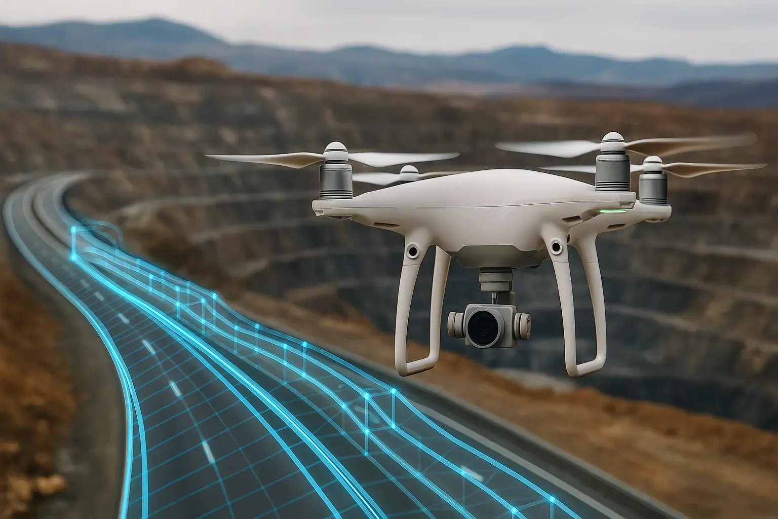
As drone programs scale, many companies are moving from raw aerial imagery to integrated digital workflows. One major leap is the adoption of digital twins: up-to-date 3D models generated by drones and integrated into BIM or GIS platforms. These models offer a “single source of truth,” allowing teams to track changes, plan proactively, and collaborate across departments. But how exactly are these twins built and used?
Traditional workflows often rely on outdated or fragmented data. A contractor may work from old site plans, while asset managers reference spreadsheets. This disconnect causes delays and costly miscommunication. A 2024 report found that data silos contribute to 35% of project delays in infrastructure. Digital twins aim to solve this by unifying drone data with enterprise systems—eliminating manual updates and enabling faster, data-driven decisions.
Building a connected workflow with drone digital twins
Creating a digital twin starts with high-resolution drone imagery or LiDAR scans. These datasets are processed into photogrammetric 3D models or point clouds. Through cloud APIs and integration tools, these models sync with GIS and BIM platforms. From there, teams can annotate, measure, and track site changes—ensuring that decisions reflect the latest ground truth. This connected workflow is revolutionizing industries from civil engineering to utilities.
- Syncs drone data with enterprise tools like ArcGIS or Revit
- Enables project-wide access to real-time visual data
- Reduces rework by keeping everyone aligned with current site models

Results / Benefits
Digital twins from drones deliver measurable impact. A European highway builder used 65,000 drone images to model a full corridor project, improving communication across teams and regulators. Companies report 30–50% faster project updates and 25% fewer data coordination issues. Integration also reduces manual reporting, improves transparency, and speeds up compliance reviews.
Conclusion
Digital twins powered by drone data are more than 3D models—they’re engines of collaboration and control. By bridging drones with BIM, GIS, and ERP systems, businesses gain visibility, reduce risk, and operate with real-time precision. Now is the time to turn drone imagery into actionable, enterprise-grade insight.
Related Inspection Posts
May 9, 2025
AI-powered drone surveys transform construction ROI
AI-powered drones are reshaping site surveys by detecting issues in real-time, cutting manual labor, and delivering impr...

May 9, 2025
New FAA drone rules to unlock BVLOS operations in 2025
New FAA BVLOS rules will eliminate many waivers and allow long-range drone missions by default. This change opens the do...

June 9, 2025
Florida's Drone Dilemma: Security vs. Hurricane Response
Florida's emergency management agencies face a critical crossroads. With the American Security Drone Act's full implemen...