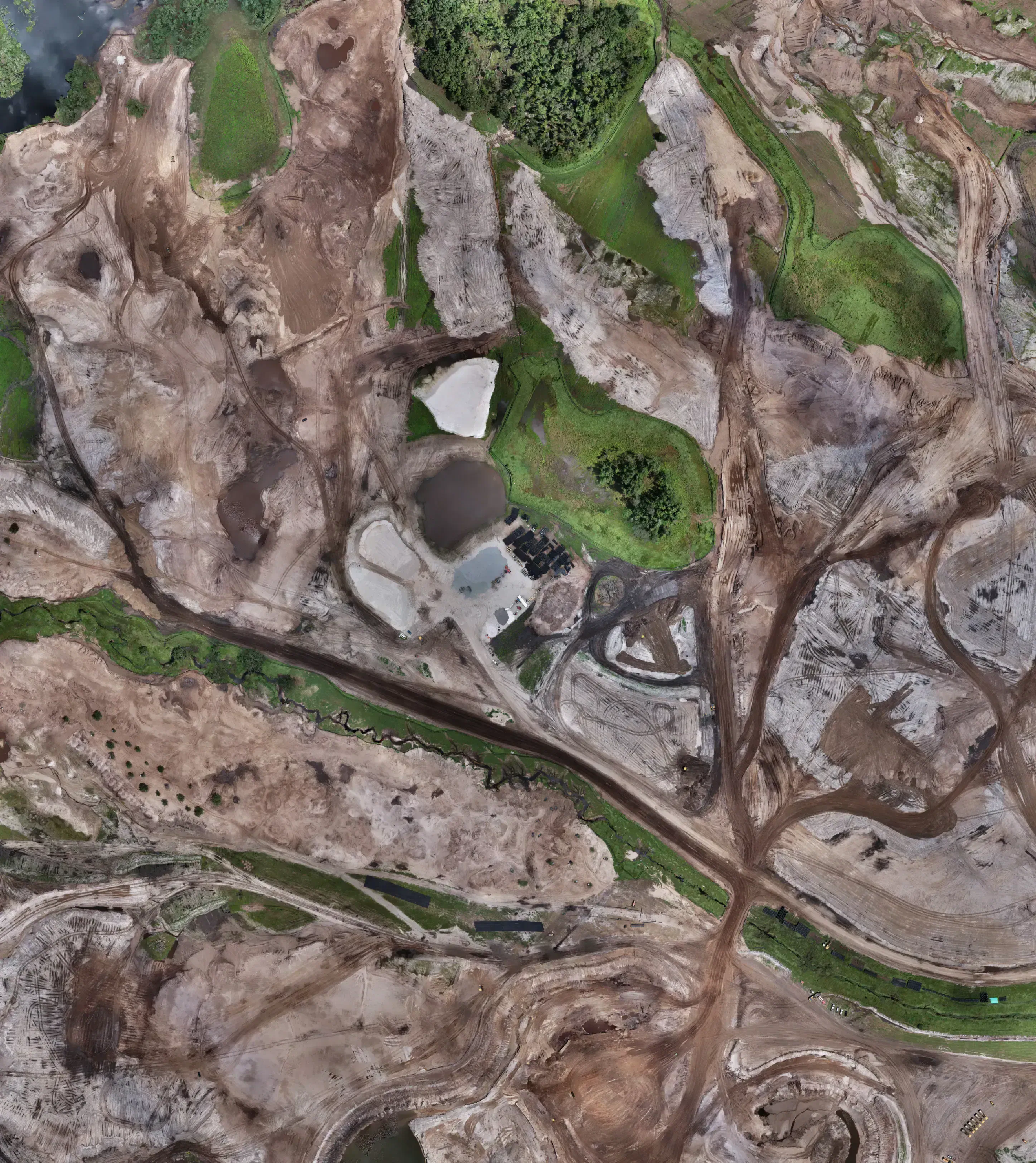
Drone topographic mapping accelerates Myakka golf project
FAST delivered a 600-acre golf course survey with cut/fill maps in under 1.5 weeks
Date Published
May 9, 2025 | 2-min read
FAST performed a full 600-acre topographic survey for a golf course in Myakka, delivering net cut/fill analysis, contour mapping, and updated imagery within 1.5 weeks—proving the value of drone mapping in fast-paced design-build scenarios.
Introduction
When a golf course development team in Myakka, FL, needed full-site mapping for a 600-acre project, they faced an aggressive timeline and diverse stakeholder needs. FAST responded with topographic drone surveys, aerial imagery, and volumetric calculations. How can fast, high-resolution mapping accelerate both design and construction in complex terrain?
Problem / Background
Large-scale land development projects often suffer from delays due to survey bottlenecks. In this case, the client faced a tight deadline and required accurate cut/fill data to coordinate course layout and material movement. Traditional surveys would have taken weeks and required multiple handoffs—slowing down both design and site work phases. Stakeholders, from architects to contractors, needed consistent, high-resolution data delivered fast.
Drone-based mapping with multi-stakeholder outputs
FAST executed the Myakka survey using high-end multirotor drones, RTK geo-positioning, and a dedicated project pipeline to deliver topographic maps, cut/fill calculations, and current aerial visuals. Our unified approach allowed us to serve both the design team—who used our contours and elevation data—and the site work contractors—who needed accurate volume estimates for material transport.
Our ability to combine capture, QA, and export in one automated workflow ensured delivery of all datasets in less than 1.5 weeks.
- Detailed contour maps supported golf course elevation planning
- Cut/fill data enabled efficient earthwork execution
- High-res aerial imagery improved team-wide site awareness
Results / Benefits
The client’s design team used FAST’s contour and elevation models to optimize the golf course layout and drainage strategy. Meanwhile, contractors leveraged cut/fill maps to minimize material movement and costs. All parties received usable data within a compressed 1.5-week window, keeping the project on schedule.
- Time reduced from **~3 weeks** to **under 1.5 weeks**
- Accuracy improved from **±0.5 ft** to **centimeter-grade validation**
- Cost savings of **15–20 %**
Conclusion
By delivering high-resolution drone mapping for a 600-acre golf course in under two weeks, FAST demonstrated the power of topographic intelligence at speed. From design layout to excavation strategy, this project exemplifies how modern survey methods keep projects moving.
Explore More Success Stories
FAST’s Aerial Solutions have revolutionized multiple industries, providing precision data and operational efficiency

May 9, 2025
Clewiston sugar plant relies on monthly drone surveys
Each month, FAST delivers precise stockpile data to the Clewiston sugar plant—supporting a multi-billion-dollar supply c...

May 9, 2025
Drone stockpile surveys streamline Pensacola asphalt operations
Recurring drone surveys at the Pensacola Asphalt Plant ensure precise material inventory and airspace compliance. FAST’s...