Drone Stockpile Analysis for Accurate Inventory Measurement
Track material volumes with repeatable drone stockpile surveys for better inventory planning.
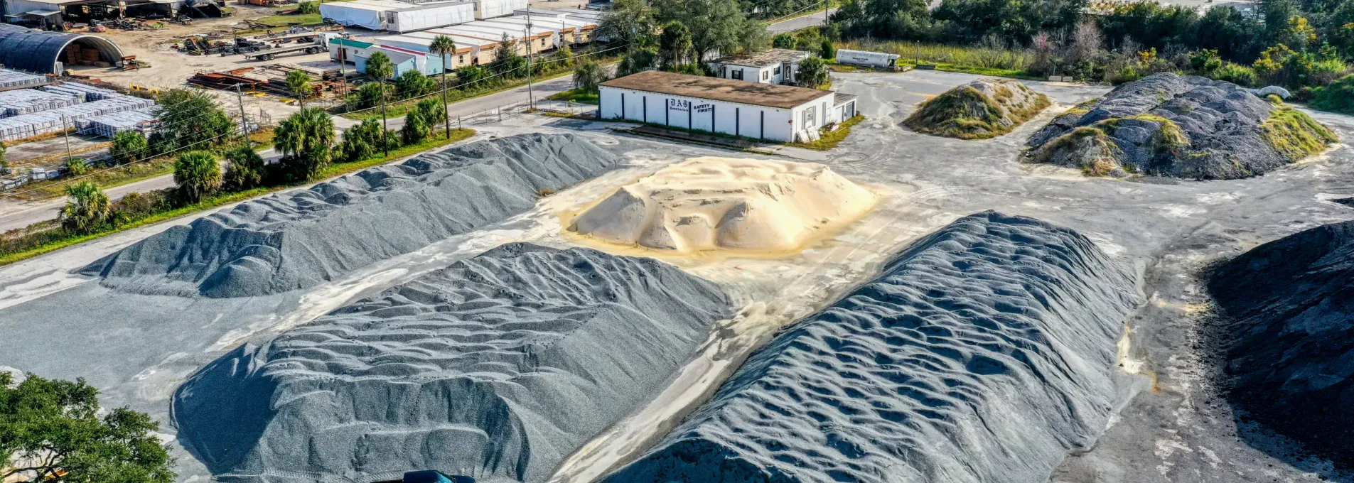
Monitor Material Volumes Without Guesswork
FAST's stockpile mapping provides visual consistency across timeframes—supporting volume tracking for operations, logistics, or site planning.

Volume Trends by Pile
Our systems map and compare pile data such as volume and footprint, with tools to convert into weights and tonnage and track trends.

Consistent Services and Timelines
Whether you fly one time or every month, our processes and timelines are reliable.

Inventory Cycle Aligned
With packages for on-demand, monthly, quarterly, biannual, and custom schedules we have options for even the busiest of stockyards.

Remote and Unobtrusive
Flights are coordinated around operations—no need to pause activity.
Volume Estimation from Surface Models
We capture surface detail to estimate and compare stockpile volumes over time—supporting inventory checks and operational reviews.

Workflow Overview
Flight capture over piles with drone photogrammetry and GCPs.
3D surface generation from imagery inputs.
Comparison and volume analysis digitally, with signed and sealed PDFs for legacy needs.
Key Volume Metrics
≤ 5%
Volume accuracies within 5% or better verified with our RTK GCP workflows.
5–8 days
Standard delivery for sites under 30 acres and 25 piles. Rush options available in as little as 3 days.
Cycle-Aligned
Optimized processes and turnarounds for monthly, quarterly, biannual or batch-based inventory surveys.
Recurring or Spot-Check Ready
Whether it's a one-time inventory check or monthly tracking, we match your operational rhythm.
Single Stockpile Session
Capture volume reference and spatial layout on demand.
Request a One-Time SurveyMonthly or Seasonal Cycles
Monitor cycle-based volume changes in sync with your reporting cadence.
Talk About Recurring PlansValuable Across Field Operations
Stockpile Surveys support inventory tracking and material management in diverse operational settings.


Where Stockpile Surveys Add the Most Value
These regions show how FAST adapts stockpile workflows to each site's scale, rotation rate, and regulatory needs — but we operate statewide.
Common Questions—Answered
Here are the top questions clients ask us about Stockpile Surveys.
With RTK/PPK corrections and ground control, volume accuracy is typically within 3-5% —suitable for audits, inventory control, and logistics planning.
Our service provide both a signed and sealed PDF and a digital interface for tracking materials. This interface, built in-house by the FAST development team, allows clients to see their sites, view stockpile data, input specific weights of materials, store material information, compare previous data to current data, and more!
Yes. We offer 48-hour rush delivery for qualifying sites, depending on airspace and weather conditions.